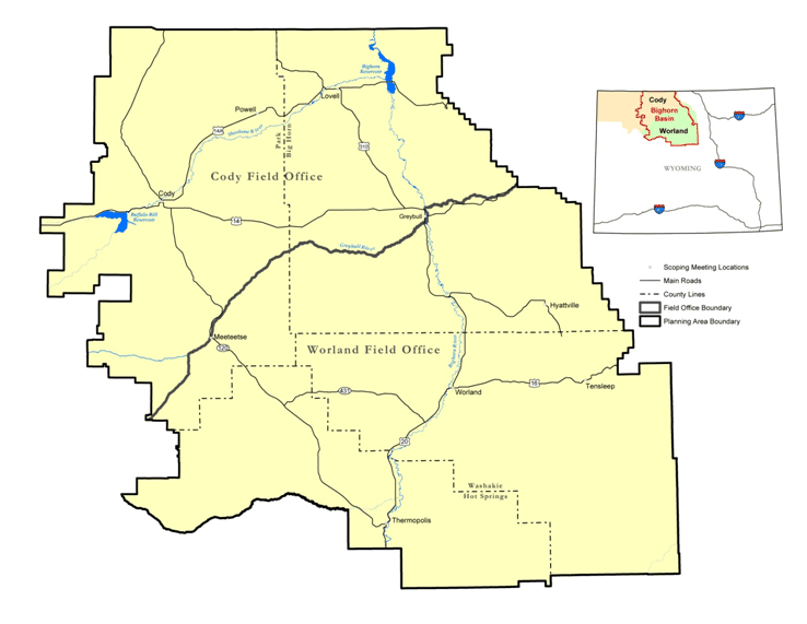
As defined in the FLPMA, “… public lands means any land and interest in land owned by the United States within the several States and administered by the Secretary of the Interior through the Bureau of Land Management….” The U.S. Department of the Interior (DOI) BLM CYFO and WFO are responsible for managing most public lands in Wyoming’s Big Horn, Park, Washakie, and Hot Springs Counties. County governments are responsible for land use planning for private lands in their jurisdictions.
BLM-administered surface lands in the Planning Area are mostly large blocks, with some scattered tracts intermingled with state and private lands (see Map 1). There also are areas in which different parties own surface rights and subsurface rights (such as the rights to develop minerals) for a piece of land, including federal minerals under privately owned surface, referred to as split-estate land. In these situations, mineral rights are considered the dominant estate, meaning they take precedence over other rights associated with the property, including those associated with owning the surface. These areas with scattered surface land patterns and varied mineral ownerships affect management options. On split-estate lands, the mineral owner must show due regard for the interests of the surface estate owner and occupy only those portions of the surface reasonably necessary to develop the mineral estate. Intermingled private lands also affect access to BLM-administered lands and cause fragmentation. Appendix A provides details regarding split-estate lands and BLM administrative responsibilities for managing the federal minerals. Tables 1–1 and 1–2 and summarize the surface and mineral ownership and administrative relationships in the Planning Area. The Approved RMP will not include planning and management decisions for private, State of Wyoming, or local government-owned lands or minerals (see Map 2).
Table 1.1. Surface Acreage in Each County of the Planning Area by Jurisdiction
| Agency | Big Horn County | Hot Springs County | Park County | Washakie County | Totals |
|---|---|---|---|---|---|
| Bureau of Land Management | 1,160,604 | 485,339 | 624,535 | 919,266 | 3,189,743 |
| Bureau of Indian Affairs | 0 | 122 | 0 | 0 | 122 |
| Bureau of Reclamation | 20,378 | 0 | 64,973 | 1,419 | 86,771 |
| Department of Defense | 3,543 | 0 | 0 | 0 | 3,543 |
| U.S. Forest Service | 2 | 0 | 0 | 0 | 2 |
| National Park Service | 15,671 | 0 | 0 | 0 | 15,671 |
| State of Wyoming | 74,343 | 83,939 | 156,657 | 102,377 | 417,317 |
| Island[a] | 96 | 0 | 0 | 78 | 174 |
| Private | 392,944 | 389,751 | 765,594 | 374,843 | 1,923,132 |
| Water | 2,280 | 2,133 | 6,721 | 1,161 | 12,295 |
| Totals | 1,669,861 | 961,284 | 1,618,481 | 1,399,144 | 5,648,770 |
| Source: BLM 2009a | |||||
[a] Land within waterways. | |||||
Table 1.2. Acreage of Subsurface Mineral Ownership in Each County of the Planning Area by Jurisdiction
| Agency | Big Horn County | Hot Springs County | Park County | Washakie County | Totals |
|---|---|---|---|---|---|
| Bureau of Land Management | 1,293,883 | 721,577 | 1,055,815 | 1,148,514 | 4,219,790 |
| Other (state, federal, and private) | 375,978 | 239,706 | 562,677 | 250,630 | 1,428,981 |
| Totals | 1,669,861 | 961,284 | 1,618,482 | 1,399,144 | 5,648,770 |
| Source: BLM 2009a | |||||
