3.4.3.1 Affected Environment
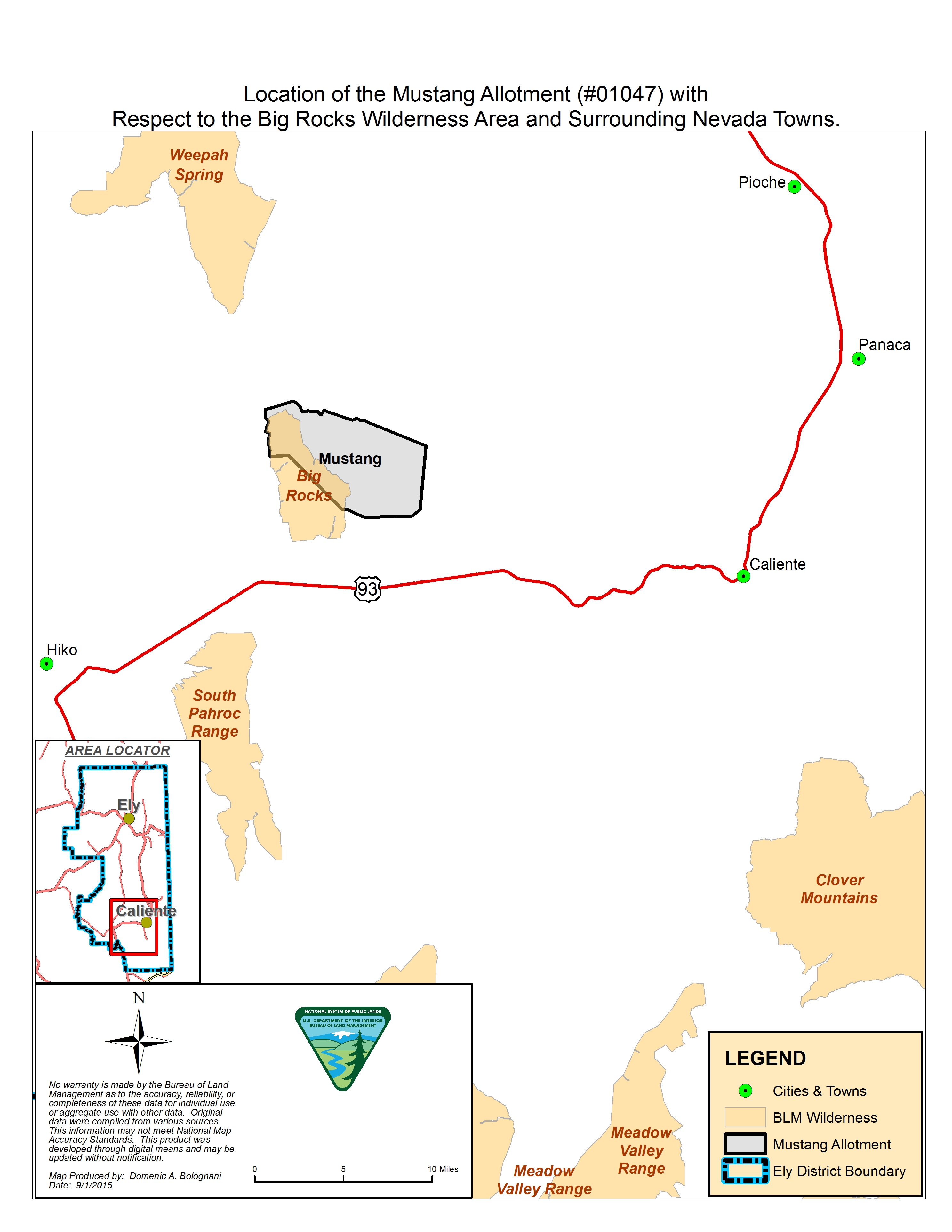
Mustang Allotment
The 24,100 acre land based Mustang Allotment (#01047) has one permittee (#2703639) and is located approximately 20 miles northwest
of Caliente in south-central Lincoln County, Nevada (following map). Elevations range from approximately 6,600 feet in the
mountains, in the central portion of the allotment, to approximately 4,700 feet near the east boundary. Cattle are the type
of livestock grazed on the allotment.
Location of the Mustang Allotment with Respect to the Big Rocks Wilderness Area and Surrounding Nevada Towns.
The Mustang Fire (#C2HR), caused by lightning, started on July 25, 2006 and burned 2,969 acres (Figure 3.2). Approximately
1,375 acres of the fire was aerially seeded on February 21, 2007.
Location of Mustang Fire Fence, Mustang Fire Fence Extension, Existing Watering Locations, the Big Rocks Wilderness Area,
and Pipelines on the Mustang Allotment.
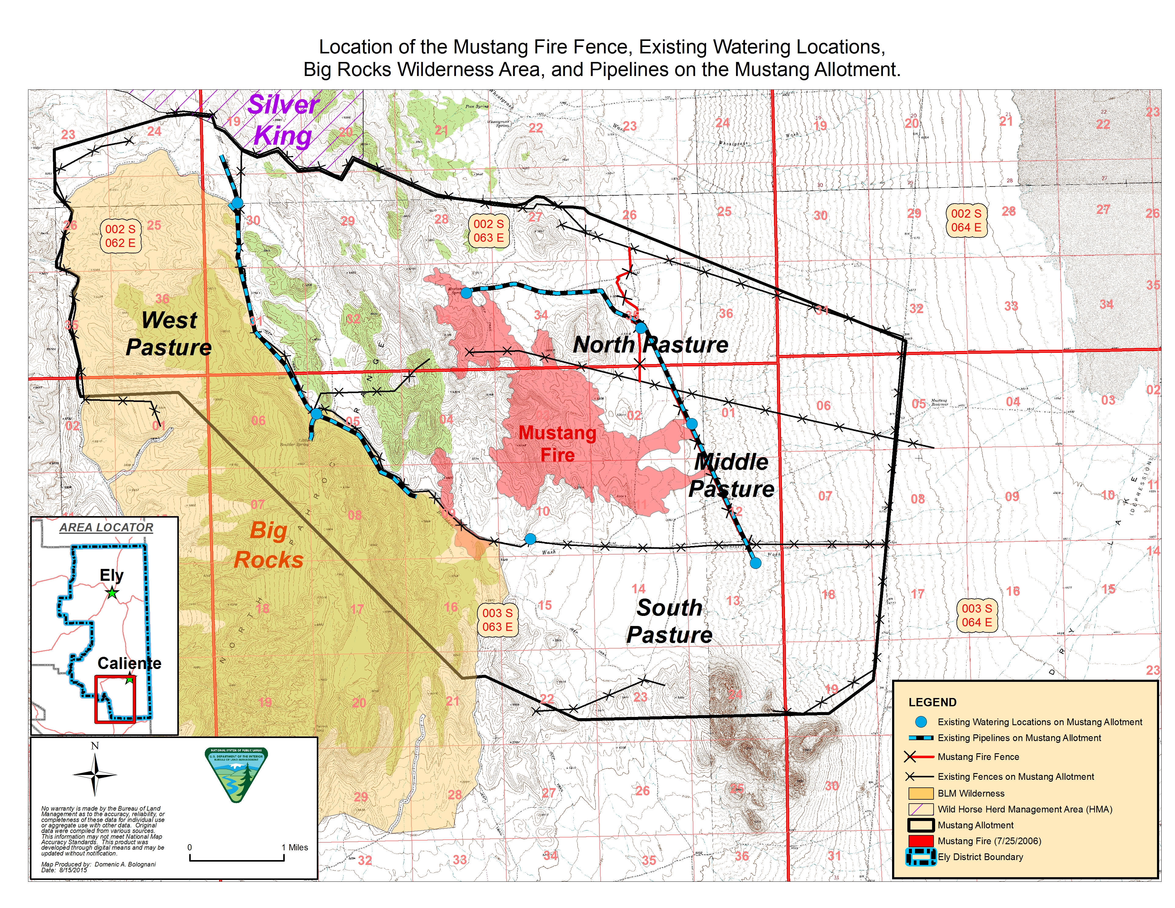
The Mustang fire fence was constructed in January 2008 to prevent livestock access to the burned area. The area associated
with the Mustang fire fence is characterized by relatively flat terrain with an occasional gentle rolling hill. Dominant
vegetation in the area of fence construction consists of Wyoming big sagebrush (Artemisia tridentata ssp. wyomingensis), Indian ricegrass (Achnatherum hymenoides), and needleandthread (Hesperostipa comata). Prior to the construction of the Mustang Fire fence the allotment was divided into the following four pastures: the north
pasture, middle pasture, south pasture, and west pasture. The fire fence further divided the north and middle pastures each
into an approximate east and west half.
The Mustang Fire fence does not occur within desert tortoise habitat, a wilderness or wilderness study area or a Wild Horse
Herd Management Area (HMA).
Barclay Allotment
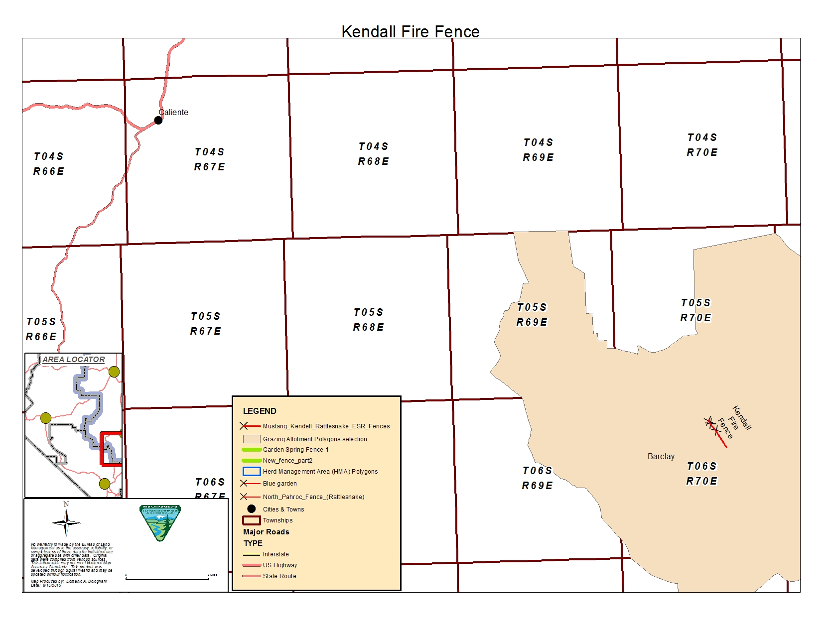
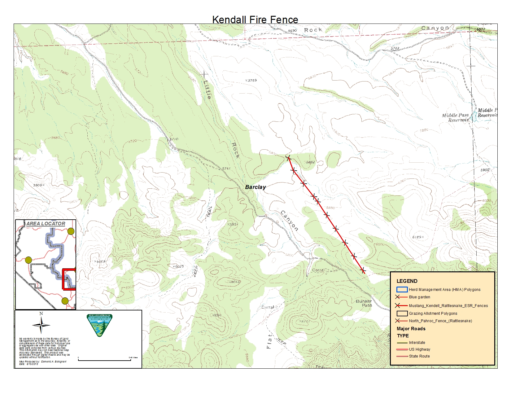
The Kendall fire fence is located in the Barclay Allotment and the eastern portion of the Clover Mountains in Lincoln County,
Nevada approximately 23 miles southeast of Caliente, NV. The allotment is approximately 82,000 acres in size with elevations
ranging from 5,500’ to 6,500’ above sea level. There are three grazing permittees authorized for grazing on this allotment.
Location of the Barclay Allotment with Respect to Surrounding Nevada Towns.
Ignited by lightening, the Kendall Fire (2000) burned approximately 805 acres of pinion-juniper dominated area. The fire
consumed most of the pinion-juniper overstory and the burned areas became dominated with annual and perennial grasses and
forbs as well as sagebrush. The terrain is semi-rugged with slopes ranging from 5-45%. The burn area was seeded with native
and non-native species. The Kendall fire fence was constructed to restrict livestock access to the newly seeded burn area.
The Kendall Fire fence does not occur within desert tortoise habitat, a wilderness or wilderness study area or a Wild Horse
Herd Management Area (HMA).
Kendall Fire Fence — Barclay Allotment
Garden Spring Allotment
The Garden Spring Allotment is a cattle grazing allotment approximately 39,000 acres in size. The allotment has one grazing
permittee. The season of use is from November 1 through April 30.
Blue Garden Fence — Garden Spring Allotment, Clover Mountains Wilderness, and surrounding Nevada Towns
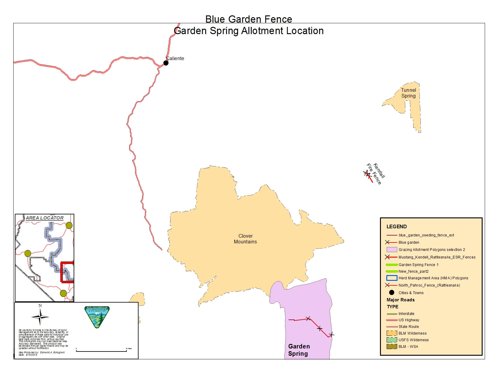
In 1999 the Blue Garden Fire burned 9,700 acres south of the Clover Mountain WSA (Wilderness Study Area) and 1400 acres within
the WSA (this WSA has since been designated as the Clover Mountains Wilderness area) area was located on the southern slope
of the Clover Mountain range. Most of the fire was located within the Garden Spring grazing allotment.
The fire burned in a transition zone between the Great Basin and the Mojave Desert. This transition zone ranges from blackbrush
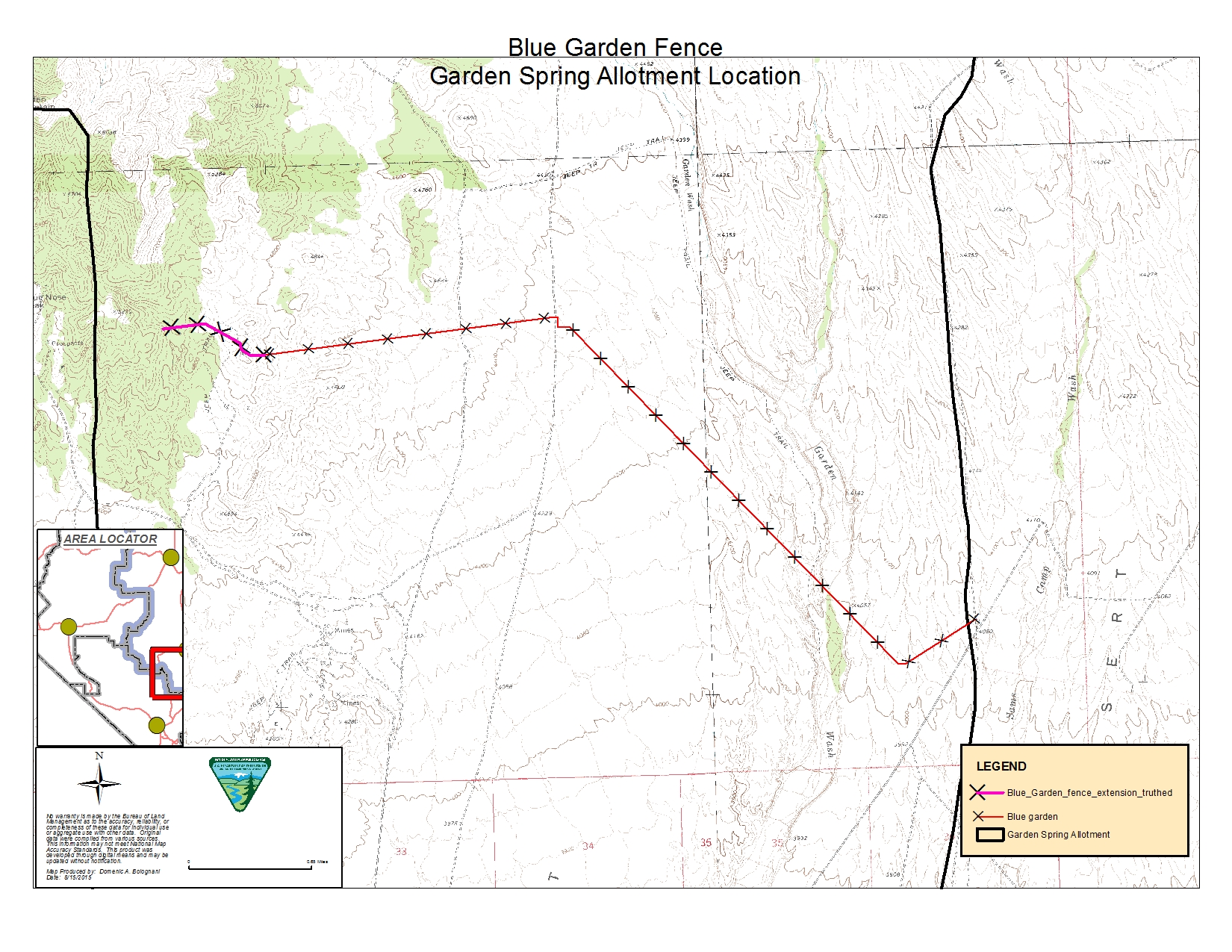
(Coleogyne ramoissisma)dominated sites to the south to pinion-juniper (Pinus edulis-Juniperus osteosperna)dominated sites in the north with chaparral communities in between dominated by live oak (Quercus turbinella).The Blue Garden Fence was constructed to protect the seeding of the burn area.
Blue Garden Fence — Garden Spring Allotment
Rattlesnake Allotment
The Rattlesnake Allotment is located 20 miles northwest of Caliente, Nevada. The current active AUMs for the approximately
35,000 acre Rattlesnake Allotment is 1,180 AUMs for cattle. The season of use is October 16 to May 30 and there is one permittee
authorized on this allotment. Elevations range from 6,500’ to 4,600’. The allotment is adjacent to The Weepah Spring and Big
Rocks Wilderness Areas, and the Silver King Horse Management Area.
Location of the Rattlesnake Allotment with respect to Weepah Spring and Big Rocks Wilderness Areas, Horse Mangement Areas
(HMA) and surrounding Nevada towns.
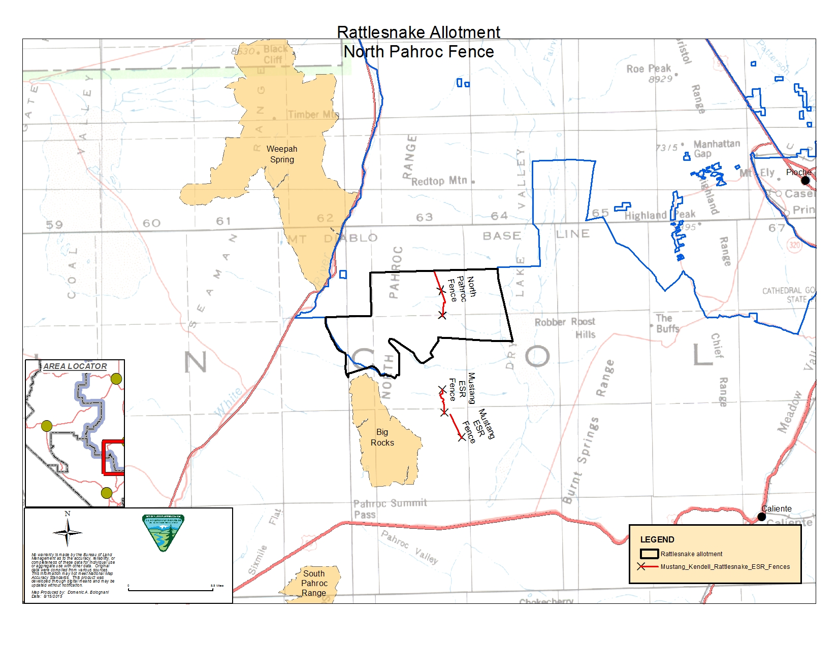
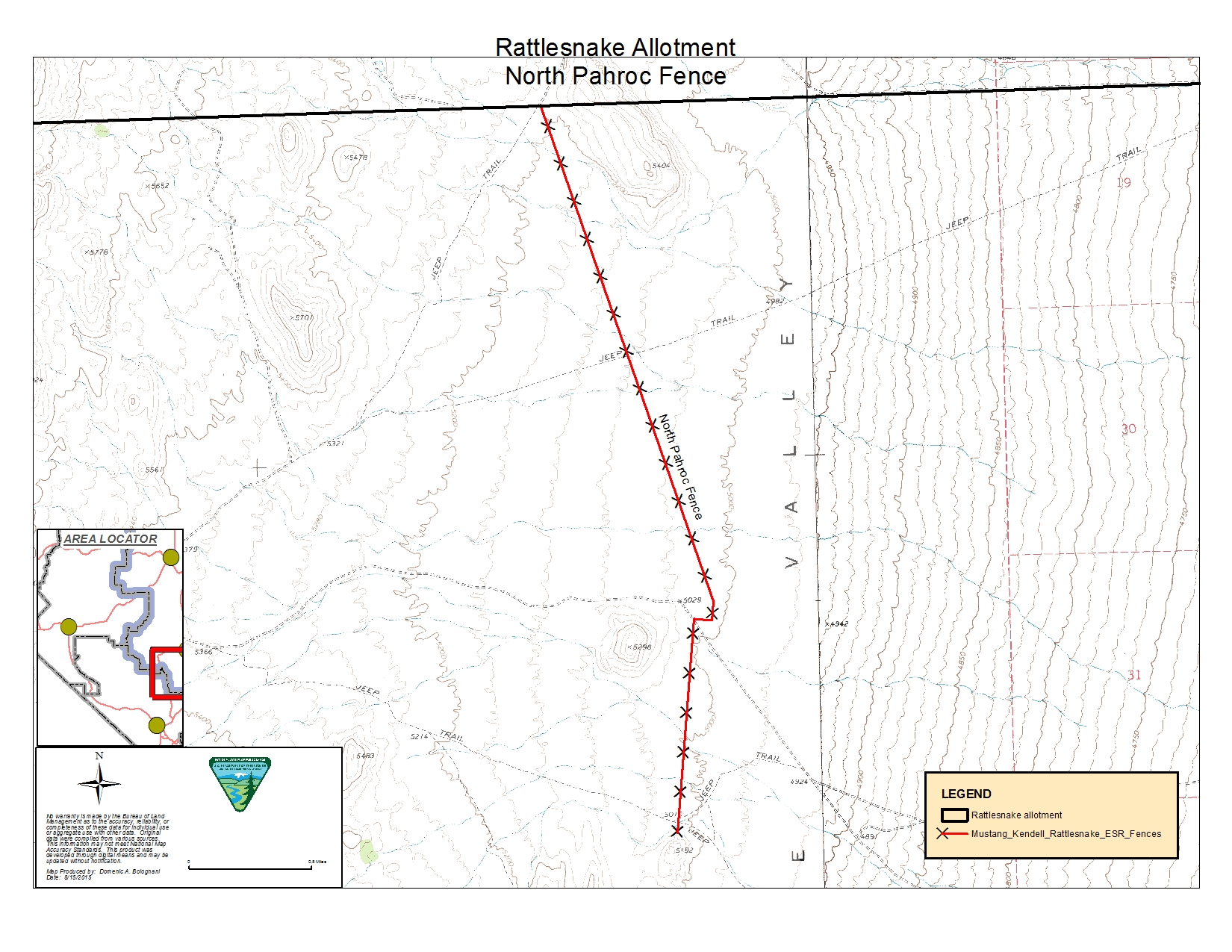
The North Pahroc Fire (Y109) was ignited by lightening on June 6, 2002 and burned 2079 acres of BLM administered land. As
a result, 700 acres were reseeded and 3.25 miles of new fence was constructed to protect the seeding until it became established.
North Pahroc Fire Fence —Rattlesnake Allotment
